
Recently, maybe a few weeks or months ago, Google Maps added street data for Israel. Before, they only had limited Satellite data for the country. But now, you can get street outlines with very limited street names in the map product.
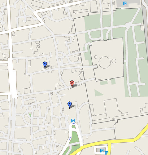
Here is an static image of the map of the "Old City" in Jerusalem. The blue markers represent where I stayed and learned for about 4 months of my life. The green patch at the bottom was a place we played soccer. The outline with the square box and circle in the middle, is the Western Wall and Temple Mount.
Notice the interactive version still has no street data. Here is a live embedded map, which will likely change to show streets in the future:
View Larger Map
In any event, a Google Groups thread asks when the street outlines will be coming to the mobile version. Google Maps Tom hinted that it would be soon, he said:
Map data that appear on the desktop version Google Maps generally makes its way over to the mobile version. I don't have an exact timeframe for when roads in Israel will be updated, but you can expect that they'll appear eventually :)
Forum discussion at Google Groups.