
In April, Google added the My Maps feature which gave users the ability to personalize their maps with lines, shapes, text, photos, and video. Now, they've gone a step further with personalization. From a WebmasterWorld thread, the new features allow users to "plot the locations of everything from local fuel supplies, to the newest earthquakes, worldwide." To do so, My Maps has added both internal and third-party Mapplets functionality, which allows you to install mini-applications on Google Maps.
Reuters goes into the features in more depth:
One map application allows users to watch YouTube videos based on the locations where they are uploaded. One could switch from the video confessions of a teenager in Ohio to tourist videos shot in the Andes mountains of South America.
That's pretty cool stuff.
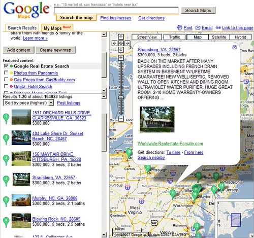
Here's a look at the real estate Mapplets:
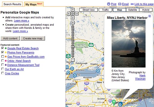
And here's integration with one of Google's most recent acquisitions, Panoramio:
The Google LatLong blog calls this Google Maps Mashup 2.0, explaining that "you can now layer information from multiple sources on the same map as well as save content that's relevant to you into a personal map."
They also shared this video on how it's done:
Gary Price adds on ResourceShelf that Ask.com offers similar features, including a near real time earthquake map and the features within Ask City.
Forum discussion continues at WebmasterWorld.